


Is water a commodity? How does the production of water work? What is groundwater and why should you care? Let’s have a look at the basics of the industrial production of water.
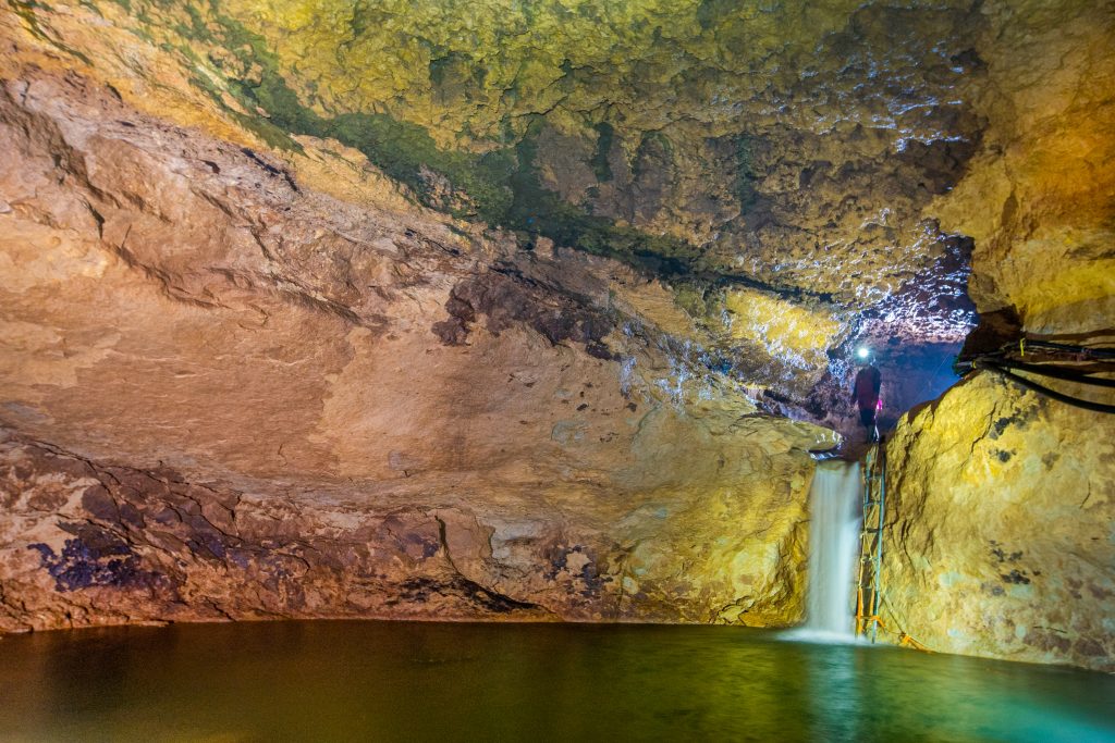
What is groundwater?
Groundwater is located below the Earth’s surface, it fills pores, cracks, and other voids of rocks in liquid, solid or gaseous states. Groundwater does not normally occur in underground streams, lakes, or veins. Groundwater is found in soils and sands able to retain the water – like a sponge holds water.
Groundwater was formed mainly as a result of infiltration of precipitation and surface waters, condensation of water vapor, magmatic processes, and metamorphism.
One important distinction to make is between groundwater that is closely associated with surface water and deep groundwater in an aquifer (sometimes called “fossil water”).
Important distinction:
– groundwater from surface water
– “fossil water” (ie groundwater from an aquifer)
The entire space from the Earth’s surface to groundwater is called the aeration zone, in which water seeps from the surface.
The depth at which soil pore spaces or fractures and voids in rock become completely saturated with water is called the water table. The water table is the upper surface of the zone of saturation, where the pores and fractures of the ground are saturated with water.
Below the water table, in the zone of saturation, you’ll find aquifers, which are the layers of permeable rock that yield groundwater.
Aquifers are the layers of permeable rock that yield groundwater.
Aquifers that are separated from each other by layers of impermeable (waterproof) or poorly permeable rocks are called interlayer aquifers. They are usually under hydrostatic pressure, and less often have a free surface.
In some cases, the groundwater in an aquifer, tectonic, or karst zone with a high filtration rate moves. This phenomenon is called groundwater flow. And when the movement of groundwater happens due to hydraulic pressure or gravitational forces the phenomenon is called groundwater runoff. Generally, such runoffs are directed toward an open sea, riverbed, or lake.
Theories of the origin of groundwater
Infiltration theory.
French scientists B. Palissy and E. Marriott in the 16th century postulated that the formation of groundwater occurs by seepage into the rocks of precipitation.
Condensation theory
The German hydrologist O. Vogel argued in 1887 that groundwater is formed by the penetration of air into the rocks and the subsequent condensation of water vapor from it.
Juvenile theory
The Austrian geologist E. Suess in the early twentieth century hypothesized that groundwater is formed from water vapor and gaseous products that are released from molten magma in the deep bowels of the earth; entering the higher layers of the Earth’s crust, they condense and give rise to juvenile waters.
Relict origin of groundwater
Finally, according to the theory of the relict origin of groundwater, groundwater of deep zones is residual water of ancient basins, buried in the sediments formed in these basins.
Quality of groundwater
Groundwater is a mineral resource (“fossil water”) whose reserves, unlike other types of minerals, are reproducible.
Groundwater is a natural solution that may contain more than 60 chemical elements (most often – K, Na, Ca, Mg, Fe, Cl, S, C, Si, N, O, H), as well as microorganisms. In addition to minerals and metals dissolved in groundwater, groundwater may also be saturated with gases (CO2, O2, N2, etc.).
Because it’s shielded under the ground, groundwater tends to be more protected from external pollution than surface water. For this reason, groundwater is commonly used for various industrial purposes such as water supply, industry, and agricultural irrigation.
Groundwater moves slowly through an aquifer, and it has a lot of contact with the surrounding rock or sediment. In most aquifers, the geological materials that compose them are relatively inert or are made up of minerals that dissolve very slowly into the groundwater.
Over time, the concentration of metals and minerals in groundwater tends to increase because it remains in contact with the aquifer, which may be rich in chemical substances. This means that in some areas where rock or sediment includes minerals that could potentially pollute the water and thus not all groundwater is suitable for water supply human consumption or agricultural use. Their total content of elements dissolved in it or the presence of specific components may render it useless.
Conversely, in some cases, it’s precisely the contents of underground waters that make them attractive as mineral waters for medicinal or balneological purposes, or even as heat and energy sources (thermal waters).

Standards and Quality
Many countries have their own standards and requirements for the quality of groundwater for different uses. Such standards usually contain a list of components and their maximum permissible concentration for a certain volume of water.
International recommendations and standards:
- Guidelines for drinking-water quality (GDWQ) published in 2011 by The World Health Organization (WHO);
- regulation of water quality in the section of ICS 13.060, ranging from water sampling, drinking water, industrial class water, sewage, and examination of water for chemical, physical or biological properties published in 2011 by The International Organization for Standardization (ISO);
- ICS 91.140.60 covers the standards of water supply systems.
Quantity of groundwater
Over 97% of all water on the Earth is salt water concentrated in the oceans and inland seas and thus unusable as fresh water. Another approximately 2% is freshwaters trapped in ice sheets and mountain glaciers, and only less than 1% is fresh water from lakes, rivers, and groundwater.
Luckily, humans have developed technologies that allow us to purify and desalinate saltwater – but their implementation can be expensive and energy-intensive. Thus these technologies are generally only deployed when fresh water is strictly required for human consumption.
While 1% of the total amount of globally available water is freshwater, only a small percentage can be used directly without chemical treatment or industrial extraction. The main reason is unsuitable quality or complex extraction requirements.
How to determine how much groundwater exists?
Quantifying water reserves is a complicated endeavor given its constant replenishment and dependence on many factors such as climate, precipitation, and constant water withdrawal.
An important distinction is the difference between reserves and resources.
Groundwater reserves refer to the amount of water contained in any element of the underground hydrosphere.
Groundwater resources refer to the amount of their renewal in natural conditions or during operation for a certain period of time.
Thanks to special software and compounding the ever-growing body of scientific literature, hydrogeologists constantly monitor the amount of groundwater and build advanced models that examine the presence of groundwater.
Once a hydrologist has constructed a model of a watershed (the land area that contributes water to a stream, lake, or aquifer) or reservoir (body of water), the hydrogeologist tests it by comparing its calculated predictions with actual results in the natural environment.
Hydrologists improve the accuracy of their models by constantly adding new relevant data to the model and retesting it. Computer models help hydrologists estimate that natural and man-made changes occur in groundwater and their effect on water supplies and flow in the future.
Extraction of groundwater
Groundwater is also often used in agriculture, municipal, industrial sectors, and water supply. But to obtain the water from the well a pump is required.
The most popular water extraction method is through the construction and operation of production water wells (tube wells or boreholes).
Wells are designed depending on their location and purpose of use. The corresponding drilling rig is also selected, it’s always a fairly complicated and expensive machine. Drill rigs are often mounted on big trucks and use rotary drill bits that chew away at the rock, percussion bits that smash the rock, or if the ground is soft, large auger bits.
The deeper the drilling, the more expensive it is to deploy and maintain a well. In addition to that, the cost may increase if the density of rocks is high or if the location causes problems with the transportation of equipment and technical personnel.
After drilling, the well is completed by installing a vertical pipe (casing) that helps to keep it from caving. This also helps prevent surface contaminants from entering the borehole and protects any installed pump from drawing in sand and sediment.
Hand-dug wells
In addition to drilling tube wells, hand-dug, and driven wells also exist, even if not so popular in modern times.
Compared to drilling, hand-dug wells are inexpensive and low-tech, as they use mostly manual labor to access groundwater in rural locations. They have low operational and maintenance costs because water can be extracted by hand bailing, without a pump.
Dgu wells work best if the ground is soft and the water table is shallow. Dug wells usually are lined with stones or other materials to prevent collapse and are covered with a cap of wood or stone.
Hand-dug wells are not very deep, as they cannot be dug much deeper than the water table — just as you cannot dig a hole very deep when you are at the beach… it keeps filling up with water!
Hand-dug wells have diameters large enough to accommodate one or more people with a pick and shovels digging down to below the water table. The excavation must be braced horizontally to avoid landslides or erosion endangering the people digging.
A major disadvantage of hand-dug wells is that they are shallow and do not have a continuous overlap (casing), making them subject to contamination from nearby surface sources, and they go dry during periods of drought if the water table drops below the well bottom.
Driven wells
Driven wells may be very simply created in unconsolidated material (such as sand or gravel) with a good structure, which consists of a hardened drive point and a screen (perforated pipe). The point is simply hammered into the ground, with pipe sections added as needed. A driver is a weighted pipe that slides over the pipe being driven and is repeatedly dropped on it. When groundwater is encountered, the well is washed of sediment and a pump is installed. A screen is usually attached to the bottom of the pipe to filter out sand and other particles.
They can only tap shallow water, and because the source of the water is so close to the surface, contamination from surface pollutants can occur.
There are also many different types of boreholes depending on the purpose of drilling – extraction of water, mining (oil for petroleum, natural gas), and scientific research.
Superdeep wells
The Kola superdeep well is the world’s deepest borehole, located in the Murmansk region (Russia), 10 km west of the city of Zapolyarny within the Baltic Shield with the purpose of performing scientific research. Drilling took place from 1970 to 1990 to a maximum depth of 12.262 Km with a total plan of 15 Km.
How to find groundwater?
Locating groundwater accurately and determining the depth, quantity, and quality of its water is a highly complex project. During the analysis stage, the target area must be thoroughly studied so as to identify hydrologic and geologic features that will be important to the planning and management of the resource.
The landscape can contain clues for the hydrologist about the occurrence of shallow groundwater. Conditions for large quantities of shallow groundwater are more common under valleys than under hills due to gravity and rock consistency. In some regions, the presence of “water-loving” plants, such as cottonwoods or willows, indicates groundwater at shallow to moderate depths. Alternatively, areas where water is at the surface as springs, seeps, swamps, or lakes may reflect the presence of groundwater, although not necessarily in large quantities or of usable quality.
In any case, the main takeaway is that prospecting and estimating the quality and quantity of groundwater is complex. Additionally, its existence may be dependent on the levels of precipitation and the local climate and geology.
Locating aquifers
Rocks that contain a usable supply of water are called aquifers. A good aquifer must be both porous enough to hold water and permeable enough to allow the continuous recharge of water to a well. So, it’s good to know what kind of rocks are in the research area.
Rocks that contain a usable supply of water are called aquifers.
Gravel, sand, sandstone, and limestone are among the best aquifers, but they are not very common since they represent only a fraction of the rocks in the Earth’s crust. Most rocks are fine-grained or otherwise “tight” and store or carry little water.
When locating groundwater, the hydrologist will use a geologic map of the area and gather information on the existing wells and their locations, the depth of water, the amount of water pumped, and the kinds of rock they penetrate.
Using data from existing wells is a very common procedure in the estimation of groundwater because test drills may be expensive and operatively difficult to implement.
In the absence of sufficient information, the hydrologist will drill a new well and then perform some tests. Hydrologists then collaborate with drillers and subsequently conduct tests.
Next hydrologists will implement hydrological tests such as pumping to indicate the water-bearing properties of the aquifer tapped by the well. From the tests, professionals will be able to determine the amount of water moving through the aquifer, the volume of water that can enter the well, and the effect of pumping on the water level of other wells in the area.
Nowadays, geologists have a plethora of programs and software that quantify the amount of groundwater in tested areas using information gathered during the prospecting stage, nearby exploration wells data, and geological models about the local conditions.
Regeneration of underground water
The waters of the atmosphere, surface, and underground are closely related.
Under the influence of solar heat, a continuous moisture cycle occurs in nature. Evaporation from the surface of the oceans, seas, land, vegetation, and water passes into the atmosphere in the form of vapor.
Air masses move, transferring water vapor above the Earth’s surface; under certain conditions, the vapor condenses and falls on the ground in the form of rain or snow.
The precipitation that falls partly flows into rivers, seas, and oceans, partly is spent on plant nutrition, partly seeps into the soil into rock strata, reaching the groundwater level, and partly evaporates again.
Thus, we can say that groundwater is recharged from the surface in a slow process which tends to flow from upper to lower aquifers. Lower aquifers require many years to replenish their supply as their recharge comes mainly from the overflow of the waters of the upper aquifers.
Springs
Groundwater can also release from the surface naturally at springs and seeps and can form oases or wetlands. Several factors contribute to the formation of these springs:
- crossing of aquifers by negative forms of modern relief (for example, river valleys, gullies, ravines, and lake basins);
- geological and structural features of the area (the presence of cracks, zones of tectonic disturbances, and contacts of igneous and sedimentary rocks);
- filtration heterogeneity of water-bearing rocks, etc.
Consequently, atmospheric, surface and underground waters take part in moisture circulation, and this moisture circulation affects the formation of groundwater reserves.

Groundwater pollution
A major issue in ecological hydrogeology is the pollution of groundwater as a result of human activity.
The pollution of groundwater aquifers tends to accidentally occur during the extraction and use of minerals, and as a result of mines, quarries, and oil and gas production.
Pollution caused by the disposal of household waste is also widespread, yet unfortunately hard to predict and expensive to control.
Agricultural activities with improperly organized irrigation and land reclamation can also disrupt the composition of groundwater, causing their salinity. Violation of soil cover at construction sites also intensifies the processes of groundwater salinization.
Most countries around the world have increasingly implemented legislation aimed at preventing pollution, however, sadly human-caused pollution is still rampant.
Groundwater depletion
Intensive extraction of groundwater in areas of water intake, as well as significant drainage during the construction of mines and quarries, cause the depletion of groundwater reservoirs.
As a result of the depletion of groundwater reserves, their level decreases, up to the drainage of the groundwater aquifer and the upper aquifers of pressurized groundwater.
Depletion of groundwater reserves with a decrease in their levels and drainage of aquifers can be associated with:
- the exploitation of various types of groundwater;
- drainage of the upper part of the section in the areas of the mining industry;
- a change in the natural conditions for feeding and unloading groundwater as a result of large-scale urban or industrial construction;
- deforestation;
- lowering the level of surface water in rivers or lakes.
The following are recommended as the main measures for solving the issues of “protection of groundwater from depletion”:
- the organization of strict control over the use of groundwater,
- reduction of water withdrawal in areas with an over-lowering of the level relative to the calculated values,
- and reassessment of groundwater reserves, considering their exploitation.